Corridor
Plans
The
Plan for Aldie
The
Plan for Middleburg
The
Plan for Upperville
The
1996 two-volume report, A Traffic Calming Plan for Virginias Rural Route
50 Corridor, is available at all Fauquier and Loudoun public libraries,
at the Book Chase in Middleburg, or through the Coalition.
Click
on Contact Us.
Governmental Support
Middleburg Town Council
Fauquier County Board of
Supervisors
Loudoun County Board of Supervisors
Commonwealth of Virginia
Virginia Department of Transportation
Federal Highway Administration
United States Congress
|

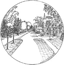
Route 50 in MIddleburg's
commercial area. |
This
section outlines the plan developed by the citizens and documented
in the 1996 report published by the Coalition. The report includes
geographical and historical background, the communitys vision,
an introduction to traffic calming, and |
| describes the communitys plan for traffic calming
Route 50. |
More than 300 people directly contributed to the plan through participation
in public workshops and an open house. Because of the way the plan was prepared in public and by the
public it enjoys a high level of community support. It is referred to as a preliminary plan because citizens will have
future opportunities to make adjustments as it is prepared in greater
detail and, ultimately, as the project is engineered for construction
|
The 1996 report details the traffic calming
features proposed for Aldie, Middleburg, and Upperville.
The supplement to the report provides reproductions of the actual
maps on which the citizens drew their traffic calming ideas and wrote
their comments.
In general the plan adheres to four principles that were developed
during the workshops:
- Travelers will be informed that they are arriving and leaving distinctive
areas through the use of entrance features. The areas include The Mosby Heritage Area,
Aldie, Middleburg, Upperville, and Paris.
- The feeling of the road between the towns will be different from the
rest of Route 50, and the feeling of the main streets in the villages
will be different from that of the road. The entrance features therefore will indicate a meaningful transition.
- The maximum posted speed limits between the villages will be 50 mph
and within the villages, 25 mph. Transition areas will be posted at 35 mph.
- Traffic calming measures will be used in the villages, not to impede
traffic, but to help self-enforce the desired speeds and to accommodate
pedestrians, cyclists, and other non-motorized users.
Outside the Villages
The design of the road outside the villages calls for:
- A paved surface that will remain at its current width edged with grass
shoulders constructed according to the National Park Services guidelines
for building stabilized grass shoulders.
- Shrubbery and trees planted and allowed to grow as close to the edge
of the road as possible.
- Guardrails, where needed, made of natural material, such as steel-reinforced
wood or concrete clad with stone similar to those used on the George
Washington Parkway (following the U.S. Department of Transportation,
Federal Highway Administrations Summary Report on Aesthetic Bridge
Rails and Guardrails, No. FHWA-SA-91-051).
- All roadside stone walls to be preserved or restored if in disrepair.
- Planted median strips or an area of white cobblestone to replace the
areas marked with painted lines at intersections where there are turn
lanes.
- Historic markers, designed with community input, explaining the rich
history of the area, and
- Pull-off areas to permit emergency vehicles to pass and to enable
visitors to stop and enjoy the scenery.
Within the Villages
To help alert drivers that they are arriving at each village,
additional precautions are taken prior to the entrance features. Where
the speed limit has been reduced to 35 mph, a series of strips of cobblestone
or paving stone are built across the road at increasingly closer spacing
to get drivers attention. Trees
or other plantings placed near both ends of the strips make the strips
more conspicuous. At the entrance
features, the speed limit changes to 25 mph.
The plan defines the main street in each village as Route 50
between the entrance features. The
street design changes so that drivers will readily perceive it as different
from the rest of the road. Where
there are no curbs, the white lines on the sides of the main streets are
replaced with rows of white paving stones embedded at street level to
form a border between the asphalt and the grass shoulders.
Where there are curbs, they are the mountable type so that vehicles
can pull over in case of a breakdown or to allow the passage of emergency
vehicles.
Typical measures within the villages include raised intersections
and raised pedestrian crosswalks, tree-planted medians, small traffic
circles, various paving materials to indicate parking, walking, and driving
areas, strategically placed greenery along the streets, and safer pedestrian
walkways, which are badly needed. For
information on traffic calming features for each village, click on:
Return to top of page
-
|